
FISH-N-MAP
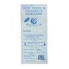
Deer Creek/Jordanelle
£58.62
£97.70
-
 Order within 6 hours and 40 minutes to get between July 4 - July 10
 -
 Tracked Shipping on All Orders
-
 14-Day Returns
- Secure Payments
-
 24/7 Customer Support
Description
"""Fish-N-Map Company underwater topography maps are printed on a waterproof, tear-resistant material and are folded to 9"""" x 4"""". When opened, each map is approximately 3' x 2' in size and is printed on both sides. These maps feature waterproof plastic """"paper""""; underwater depth contours; fish locations; latitude and longitude for GPS; often multiple lakes on one map; boat ramps; recreational facilities; and much more. Detroit Lake was created in 1953 when the Army Corp. of Engineers completed the Detroit Dam project. Detroit Lake is part of the Oregon Parks and Recreation Department and is located in Oregon's Cascade Mountains."""Shipping and Returns
- We offer tracked shipping on all orders. Tracking information will be shared as soon as the order is dispatched.
- Please check the delivery estimate before adding a product to the cart. This is displayed for every product on the website.
- Available shipping methods and charges will be displayed at the time of checkout, depending on your exact location.
- All customers are entitled to a return window of 14 days, starting from the date of delivery of the product(s).
- Customers are advised to read our return policy for details of the return process, eligibility, refunds as well as cancellations or exchanges.
- In case of any issues or concerns about Shipping or Returns, please contact us and we will be happy to help.
Fish-N-Map.
Deer Creek/Jordanelle
£58.62
£97.70