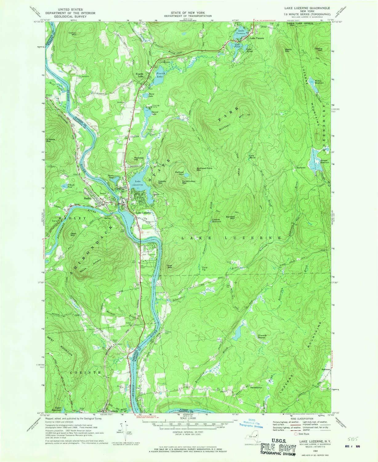
YellowMaps YellowMaps Lake Luzerne NY topo map, 1:24000 Scale, 7.5 X 7.5 Minute, Historical, 1968, Updated 1970, 26.9 x 22 in - Tyvek
YellowMaps

YellowMaps Lake Luzerne NY topo map, 1:24000 Scale, 7.5 X 7.5 Minute, Historical, 1968, Updated 1970, 26.9 x 22 in - Tyvek

$ 122.35
Pseudo Checkbox Icon
Order within 0 hours and 0 minutes to get between -
Buying Bulk?
Delivery Truck IconTracked Shipping on All Orders Secure Payments
Headphones Icon 24/7 Customer SupportReturn Product Arrow Icon14-Day Returns
Description
  • Printed on Tyvek® (synthetic)
  • USGS topographic map of Lake Luzerne, NY, at 1:24000 scale. Lighter material. Waterproof. Tear-resistant. Foldable. Very durable. Perfect for backpacking and the outdoors.
  • Cities, towns, villages: Fourth Lake,Lake Luzerne,Beartown,Hadley,Danielstown,Lake Vanare
  • Mountains: Luzerne Mountains,Mount Anthony,Bucktail Mountain,Dean Mountain,Cobble Mountain,Cobble Mountain,Bartlett Mountain,Bullhead Pond Mountain,Twist Mountain,Constitution Mountain,Darling Mountain,Rockwell Hill
  • Valleys: Low elevation topographic features such as flatlands, river valleys, and canyons.


Printed on Tyvek