
Description
- Printed on Tyvek® (synthetic)
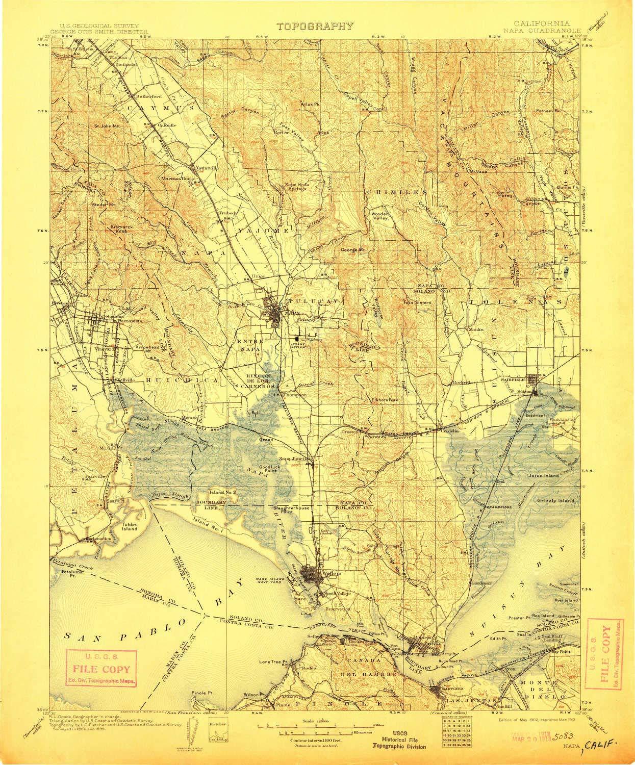
- USGS topographic map of Napa, CA, at 1:125000 scale. Lighter material. Waterproof. Tear-resistant. Foldable. Very durable. Perfect for backpacking and the outdoors.
- Cities, towns, villages: Pinole,Bayo Vista,Embarcadero,Sulphur Springs (historical),Thomasson,Jacksnipe,South Vallejo,Enchanted Hills,Greenwood (historical),Carneros (historical),Verano,Ramal,Port Chicago (historical),Harry Floyd Terrace,Benicia,Boyes Hot Springs,Ozol,Vichy Springs,Cordelia,Rodeo,Mococo,Christie,Brazos,Agua Caliente,Bucktown,Batto,Fairville,Rose (historical),Guadalcanal Village,Oakville,Big Bend,Valona,Shipyard Acres,Bonilla,Suisun,Bayview,Rockville,Thompson,Collins,Merazo
- Mountains: English Hills,Vaca Mountains,Yountville Hills,Steiger Hill,Mount Saint John,Haystack,Nob Hill,Chicken Coop Hill,Okell Hill,Suisun Hill,Atlas Peak,Twin Sisters,Oat Hill,Castle Peak,Milliken Peak,Mount Pisgah,Hogback Mountain,Signal Hill,Bush Hill
- Valleys: West Chapman Canyon,Stone Trough Canyon,American Canyon,Hooker Canyon,Sulphur Canyon,East Bull Canyon,Segassia Canyon,Coleman Canyon,Wild Horse Valley,Steele Canyon,Soda Canyon,Alhambra Valley
USGS topographic map of Napa, California, dated 1902, updated 1913.
Includes geographic coordinates (latitude and longitude), lines of elevation, bodies of water, roads, and more. This topo quad is suitable for recreational, outdoor uses, office applications, or wall map framing.
Printed on-demand by YellowMaps on the print material of your choice.
Shipping rolled from Minneapolis, MN, United States.
Product Number: USGS-5506089
Map Size: 19.9 inches high x 16.5 inches wide
Map Scale: 1:125000
Map Type: POD USGS Topographic Map
Map Series: HTMC
Map Version: Historical
Cell ID: 66156
Scan ID: 299523
Imprint Year: 1913
Survey Year: 1899
Datum: Unstated
Map Projection: Unstated
Map published by United States Geological Survey
Map Language: English
Scanner Resolution: 600 dpi
Map Cell Name: Napa
Grid size: 30 X 30 Minute
Date on map: 1902
Geographical region: California, United States
Northern map edge Latitude: 38.5
Southern map edge Latitude: 38
Western map edge Longitude: -122.5
Eastern map edge Longitude: -122
Surrounding map sheets (copy & paste the Product No. in the search bar):
North: USGS-5504613,USGS-5504617,USGS-5523865,USGS-5523861,USGS-5504615
East: USGS-5506621,USGS-5506625,USGS-5499449,USGS-5506613,USGS-5503677
South: USGS-5657937,USGS-5657921,USGS-5522629,USGS-5522619,USGS-5522633
West: USGS-5503609,USGS-5519721,USGS-5519729,USGS-5503611,USGS-5519727