


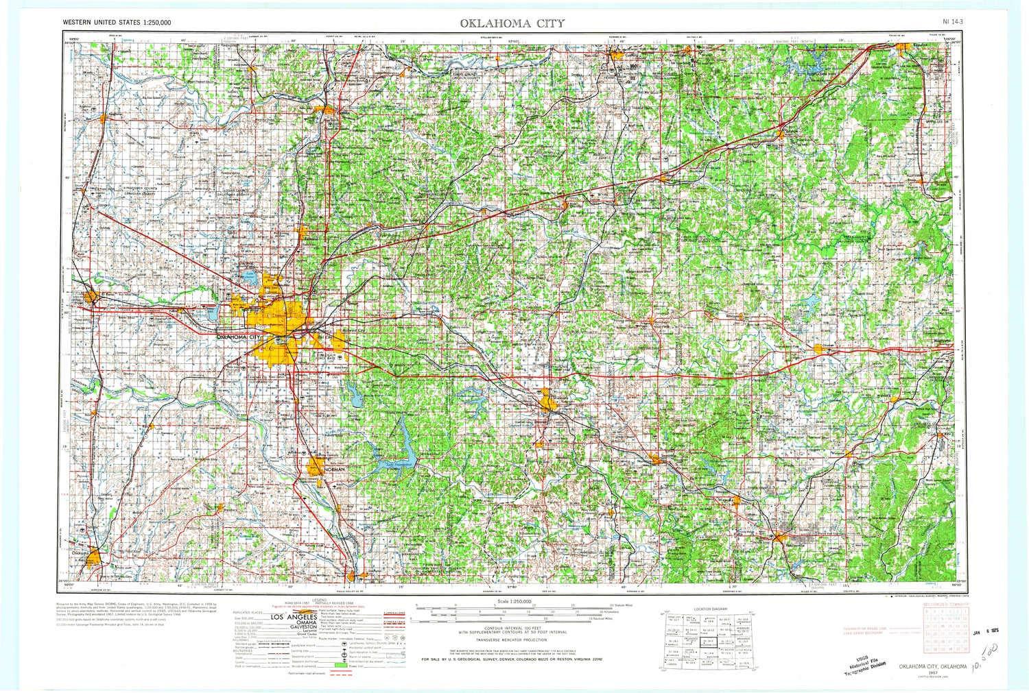

Description
- Printed on Tyvek (synthetic)
- USGS topographic map of Oklahoma City, OK, at 1:250000 scale. Lighter material. Waterproof. Tear-resistant. Foldable. Very durable. Perfect for backpacking and the outdoors.
- Cities, towns, villages: Shawnee Town (historical),Edmond,Chisney,Bearden,Nobletown,Purcell,Seward,Anderson,Blanchard,Tuttle,Wheatland,Sparks,Cromwell,Lake Aluma,Lillard Park,Trousdale,Woods,Pearson,Watkins,Lawrie,Richland,Holdenville,Ellaville,Moore,Pharoah,Anderson,Tecumseh,Okfuskee,Witcher,Payson,Morvin,Chandler,Kellyville,Green Pastures,Morse,Stroud,Denver,McLoud,Nichols Hills,Dustin,Hibsaw,Etowah,Coyle,Macomb,Langston
- Mountains: Tate Mountain,Bald Mountain,Gobblers Knob,Tabletop Mountain,Twin Mounds,Red Hill,Jenny Hill,Lamar Mountain,Chimney Rock,Fort Hill,Potato Hill,Osage Hill,Mount Williams
- Valleys: Hoot Owl Hollow,Horse Thief Canyon