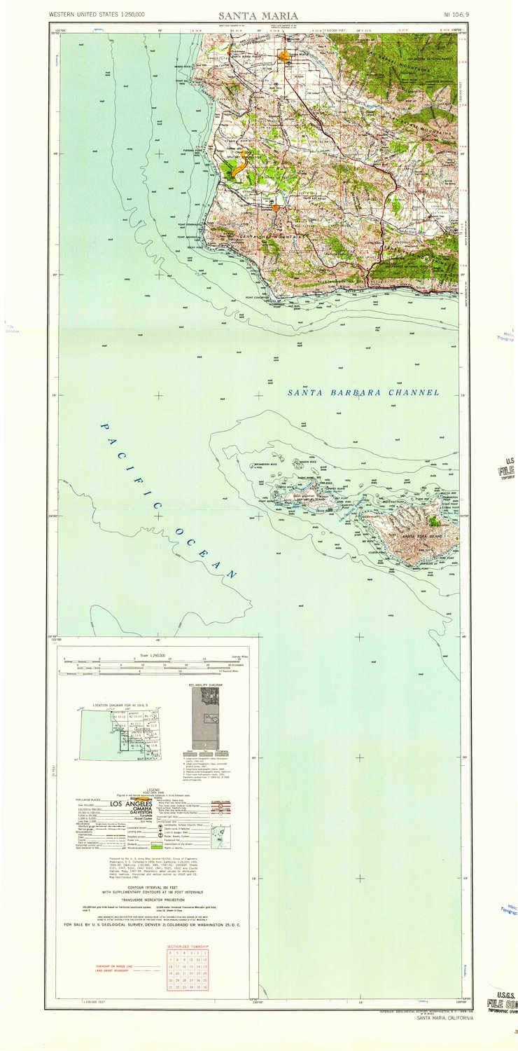
Description
- Printed on Tyvek® (synthetic)
- USGS topographic map of Santa Maria, CA, at 1:250000 scale. Lighter material. Waterproof. Tear-resistant. Foldable. Very durable. Perfect for backpacking and the outdoors.
- Cities, towns, villages: Rosemary,Tangair,Tajiguas,San Augustine,Buellton,Antonio,Kunuqug (historical),Gum,Surf,North Santa Maria,Garey,Vandenberg Village,Shisholop (historical),Mesa Oaks,Arguello,Guadalupe,Orcutt,Shuman,Santa Ynez,Ballard,Los Olivos,Mission Hills,Carr,Roadamite (historical),Sacate,Los Alamos,Lompoc Village,Bicknell,Jalama (historical),Solvang,Gaviota,Orella (historical),Midco,Ahwin (historical),Jalama,Betteravia,Port Orford,Jonata Park,Foothill Estates,Gato,Bragur,Barsug
- Mountains: White Hills,Solomon Hills,Casmalia Hills,Lompoc Hills,Promontory,Gaviota Peak,Green Mountain,Redrock Mountain,Mount Solomon,Manzanita Mountain,La Tinta Hill,Lookout Mountain,Palo Alto Hill,Wild Horse Peak,Los Coches Mountain,Bone Mountain,Mount Lospe
- Valleys: Tepusquet Canyon,Grey Canyon,Arroyo Quemado,Ballard Canyon,Canovos Canyon,Caada Del Pescado,Nipomo Valley,Caada Agua Viva,Lompoc Canyon,Kelly Canyon,Ruiz Canyon,Santa Maria Valley,Damsite Canyon
Printed on Tyvek